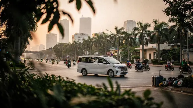
Getting Around Vietnam: How to Choose the Right Transport for Every Distance
What is the best way to get around Vietnam?
Match the transport to the distance. Fly for the long hops, because Hanoi to Ho Chi Minh City is about two hours by air and more than thirty hours by train. Use the Reunification Express along the coast, sleeper buses and limousine minibuses for medium distances, and Grab, Be or Xanh SM inside the cities.
Most mistakes in a Vietnam itinerary come from one misjudgement: the size of the country on the map. Vietnam looks like a thin ribbon, and ribbons seem easy to cross. This page gives you the overview of how people actually move around the country, which mode suits which distance, and where to go next for the detail of each one.
Why the scale of Vietnam changes every plan
Vietnam stretches roughly 1,650 km from the Chinese border to the Mekong Delta. The capital, Hanoi, sits in the north on the Red River. The largest city, Ho Chi Minh City (still widely called Saigon), lies about 1,100 to 1,150 km further south as the crow flies, and roughly 1,700 km by road or rail.
That gap decides everything. Going from north to south is a domestic flight of about two hours, or more than thirty hours on the Reunification Express. It is never a day trip, and it is never “just a detour”. A route that lists Hanoi, Hoi An and Ho Chi Minh City in a long weekend is not a plan; it is three airports and very little time on the ground.
A useful habit is to think in three regions, each with its own pace:
- The north: Hanoi, Ha Long and Lan Ha bays, Ninh Binh, Sapa and the mountains. Distances between sights are 100 to 400 km, mostly on roads that are slower than the map suggests.
- The centre: Hue, Da Nang, Hoi An, Phong Nha, then Nha Trang and Da Lat further down. The coast is a single line, which makes the train and short flights both useful.
- The south: Ho Chi Minh City, the Mekong Delta, Mui Ne, Phu Quoc and Con Dao. Distances are shorter, but islands need a plane or a ferry.
If you are still deciding how long to give the country, the how many days in Vietnam guide helps you fit a route to your time, and the Vietnam in two weeks itinerary shows what a realistic version looks like.
The logic: choose transport by distance
Rather than ranking modes as good or bad, match them to the length of the leg. This table is the whole system in one view.
| Distance of the leg | Usually best | Why |
|---|---|---|
| Between regions (north, centre, south) | Domestic flight | Saves a day or more; flights link the main cities directly |
| Along the central coast | Train or short flight | The line follows the sea and several stops are well placed |
| Medium legs (3 to 8 hours of road) | Sleeper bus, limousine minibus or private car | Frequent departures and door-to-door options |
| Short legs and day trips | Car with driver or organised tour | Fewer logistics, flexible stops |
| Inside a city | Grab, Be, Xanh SM, metered taxi, metro in Hanoi and Ho Chi Minh City | Fare shown upfront, no haggling |
| Islands (Con Dao, Phu Quoc, Cat Ba) | Plane or ferry | No other way across the water |
No mode wins everywhere. The skill is chaining them: a flight for the long jump, then a driver or an app for the last stretch.
Domestic flights: for the long hops
Vietnam has a dense network of domestic routes, run by Vietnam Airlines, Vietjet, Bamboo Airways and others. The headline legs are the ones that matter for itineraries: Hanoi to Da Nang or Hue takes about one hour fifteen, and Hanoi to Ho Chi Minh City about two hours.
For a trip of ten days or less that includes more than one region, flying is usually the sensible default. You keep your time for the places themselves. The dedicated domestic flights in Vietnam page covers airlines, baggage habits and booking tips, so this overview does not repeat them.
A few points are worth knowing at the planning stage:
- International gateways: Noi Bai (HAN) in Hanoi, Tan Son Nhat (SGN) in Ho Chi Minh City, Da Nang (DAD), Cam Ranh (CXR) for Nha Trang, and Phu Quoc (PQC).
- Domestic airports serve Hue (Phu Bai), Phong Nha (Dong Hoi), Da Lat (Lien Khuong), Quy Nhon (Phu Cat), Can Tho and Con Dao.
- Distance from the city varies a lot. Noi Bai is roughly 25 to 35 km north of central Hanoi, so allow 45 to 70 minutes by road. Tan Son Nhat is only about 7 km from the centre of Ho Chi Minh City. Da Nang’s airport is minutes from the city and about 45 minutes from Hoi An.
- No airport has a rail or metro link. In every case you finish the journey by road, which is why the next-step choice matters.
A second airport for Ho Chi Minh City, Long Thanh, is under construction. Until it is open and listed by the airlines, plan around Tan Son Nhat. For each airport and what it means for your arrival day, see Vietnam airports explained.
The Reunification Express: the line along the coast
The railway runs the length of the country: Hanoi, Hue, Da Nang, Nha Trang and Saigon, in more than thirty hours end to end, with sleeper berths for the overnight stretches. It is slow, and that is the point for many travellers. You see rice fields, fishing villages and the coast at the speed of the carriage.
The honest advice is to ride it in pieces. The section from Hue to Da Nang, over the coast near the Hai Van Pass, is the scenic one and is short enough to enjoy without losing a day. A night train from Hanoi to Lao Cai also serves Sapa, which is popular with those who want to sleep rather than sit on a mountain road.
Everything about classes, seat choice and what to expect on board is on the Vietnam train travel page. If you want a reader’s impression of the full line, the Reunification Express review is the place, and the Hanoi to Ho Chi Minh City by train itinerary turns the whole journey into a day-by-day plan.
Sleeper buses and limousine minibuses: the middle distances
Between a flight and a city taxi there is a large middle range, and buses own it. Two kinds matter.
- Sleeper buses have reclining berths and run through the night on longer routes. They are cheap and extensive, and they suit people who treat the night as a free bed.
- “Limousine” minibuses are smaller vehicles with a handful of wide seats, often with hotel pick-up. They are the usual choice for medium legs such as Hanoi to Ha Long or Sapa, or Hue to Hoi An.
Quality varies by operator, so booking through a reputable company or your accommodation is wiser than a street offer. Road conditions, not distance, set the time, and mountain routes are always slower than they look. Details and what to check before boarding are on the Vietnam sleeper buses page.
One leg deserves a separate mention. Between Hue and Hoi An the road crosses the Hai Van Pass, and many travellers choose to stop for views on the way. The Hue to Hoi An transfers page lists the options, and the Hai Van Pass tours page covers the pass itself.
Car with driver: when flexibility is worth it
A private car with a driver sits between a bus and a tour. It fits families, small groups, anyone with reduced mobility and anyone whose route has several stops that public transport does not connect cleanly. You set the pace, you can stop for a viewpoint, and luggage is no longer an issue.
Many travellers meet this mode through a day trip rather than by booking a car on its own. A guided outing from Hanoi, for example, to Ninh Binh and its limestone landscapes, is often just a car, a driver and a guide on a fixed route; a small-group day trip from Hanoi to Ninh Binh is a straightforward way to see it without arranging separate transport. The same logic applies to the north’s long-distance routes: a driver turns a hard day of connections into a comfortable one.
If you want to see the area first-hand, the Ninh Binh destination page explains how far the sights sit from each other.
In the cities: apps, taxis, metro and cyclos
Inside a city, the daily answer is a ride-hailing app. Grab, Be and Xanh SM all work for cars, and Grab and Be also offer motorbike taxis, known as xe om. The fare is shown before you accept, the route is tracked, and you avoid negotiating in a language you may not share. Metered taxis also exist; stick to well-known fleets and check that the meter runs.
Both big cities now have a metro. Hanoi has a small network, and Ho Chi Minh City’s Metro Line 1, running between Ben Thanh and Suoi Tien, opened in December 2024. They are useful for certain corridors, but they do not replace apps for most trips. Cyclos are a sightseeing ride rather than transport; agree the route and the cost before you sit down.
The practical details of using the apps, paying and avoiding common problems are on the Grab and taxis in Vietnam page.
Motorbikes: popular, but not for everyone
Traffic drives on the right and is dominated by motorbikes. Riding one yourself can be a memorable way to see the Ha Giang loop or the coast, but it carries real risks: dense, unpredictable traffic, unfamiliar road rules and, for many visitors, no valid licence. Many insurers refuse a claim if you ride without the right licence.
If you want the experience without the risk, ride pillion with a local. On the Ha Giang loop most visitors do exactly that, with an easy rider at the handlebars. Everything you need to decide on renting is on the renting a motorbike in Vietnam page.
On foot, the rule is simple: walk at a steady, predictable pace and let the bikes flow around you. The how to cross the street in Vietnam article explains the habit in more detail.
Islands and water crossings
Some destinations are only reached by air or by water. Con Dao and Phu Quoc are reached by plane or ferry, and Phu Quoc also has its own international airport. Ha Long and Lan Ha bays are reached by road from Hanoi, then by boat; many visitors combine the two in a single cruise, such as an overnight cruise on Lan Ha Bay from Hanoi. In the Mekong Delta, day trips continue by boat after the road leg from Ho Chi Minh City, and the Cu Chi Tunnels can be reached by road or, on some tours, by a speedboat on the Saigon River.
Weather affects water crossings more than any other leg. Typhoon risk in the north and centre can cancel cruises and ferries, which is covered in the rainy season and typhoons guide.
Putting it together: three sample chains
The best way to read the table above is to see it in use. These are examples of how the modes link, not timetables.
A first-time north-to-south trip. Fly into Hanoi and use apps in the city. Take a limousine minibus or driver for Ha Long or Ninh Binh. Fly from Hanoi to Da Nang for the centre, using a car or shuttle to Hoi An. Fly on to Ho Chi Minh City, then use a driver or boat for the Mekong Delta.
A slow-travel version. Fly into Hanoi, take the night train to Lao Cai for Sapa, then return. Take the Reunification Express to Hue and on to Da Nang, a bus or car to Hoi An, and then fly the last long leg to the south rather than spending another day on the line.
A single-region trip. Choose one region and stay in it. In the centre, for instance, a mix of short train rides, drivers and local tours covers Hue, Da Nang and Hoi An without any flight at all. A city outing such as a full-day guided city tour in Da Nang solves the logistics for the day.
Seasons and timing
Two things shape transport more than anything else: the weather and the calendar.
- Weather. The north and centre have a typhoon season, and the centre has a rainy season roughly from September to December, with floods most likely in October and November. The south has a dry season and a wet season, with downpours usually in the late afternoon. Check the best time to visit Vietnam guide before you lock in dates.
- Tet. The lunar new year falls between late January and mid-February, on a different date each year. Transport is fully booked, many businesses close for several days and prices rise. If your trip touches Tet, book early and keep your plan flexible.
Plan your most important legs first, particularly flights and sleeper berths, then fill in the local transport around them.
Frequently asked questions about getting around Vietnam
How long does it take to travel from Hanoi to Ho Chi Minh City?
By air it is about two hours on a domestic flight. By Reunification Express it is more than thirty hours end to end, and by road it is roughly 1,700 km, which is several days of driving. It is never a day trip, so plan it as a flight or as a deliberate multi-stop journey.
Is it worth taking the train the whole length of Vietnam?
Rarely in one go. The line is long and slow, and the best scenery is the Hue to Da Nang section over the coast. Most travellers ride the train for one or two attractive legs and fly the rest, which keeps the time spent in transit reasonable.
Can I take a train or metro from the airport into the city?
No. No airport in Vietnam has a rail or metro link. You reach the city by ride-hailing app, metered taxi, airport bus or a pre-booked transfer. Noi Bai in Hanoi is far from the centre, while Tan Son Nhat in Ho Chi Minh City is unusually close.
Are Grab, Be and Xanh SM reliable for tourists?
Yes, in the main cities they are the easiest option. You see the route and the fare before you get in, and you can pay in the app or in cash. They work for cars and for motorbike taxis, and they remove most of the haggling that happens at tourist hubs.
Should I rent a motorbike to get around?
Only if you are an experienced rider with the right licence and insurance that covers it. Traffic is dense and unpredictable, and many insurers refuse a claim if you ride without a valid licence. Ride-hailing apps, drivers or an easy rider are safer choices for most visitors.
Do I need to book transport in advance?
For flights, sleeper berths on the train and anything around Tet, yes, book early. For ride-hailing apps and most buses you can decide the same day. Peak periods fill every mode at once, so the busier the season, the earlier you should reserve.
Getting Around Vietnam
Verified deep-linked GetYourGuide tours. Book through these links and we earn a small commission at no cost to you.
GetYourGuide does not provide a product photo for this activity — the image shows the meeting point, photographed by us.