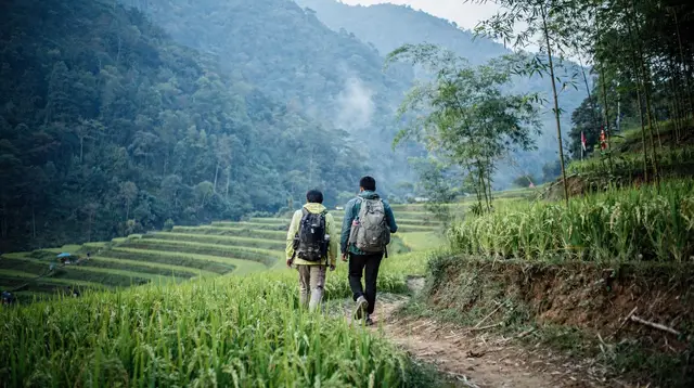
Trekking and Hiking Around Da Lat: Independent Walks or a Guided Trek
Can you trek around Da Lat, and do you need a guide?
Yes. Da Lat sits at roughly 1,500 m on the Lang Biang plateau, so walking is cool rather than tropical. Short walks near the town can be done alone, while forest treks and multi-day routes are best taken with a local guide who knows the trails and the weather.
Most people who think of trekking in Vietnam picture sweat, leeches and sticky heat. Around Da Lat that picture is wrong. The town sits at roughly 1,500 m on the Lang Biang plateau, and it is cool all year. You will walk through pine forest and past vegetable terraces in a fresh breeze, and you will probably finish the day reaching for a jacket rather than a second water bottle.
This guide frames walking and hiking in and around Da Lat: what is realistic on your own, what is better with a guide, and who each option suits. It deliberately stays practical rather than heroic. The area rewards a few unhurried hours on foot far more than a gruelling expedition, and it is one of the few places in the country where you can swap café culture for a proper walk in a single morning.
The right mental picture: cool, green and high
Da Lat is a hill town, and everything about hiking here follows from that. The air is thinner and cooler than on the coast, the light is soft, and the mornings are the best part of the day. Early walkers get mist in the valleys, cold hands and a quiet landscape. By late afternoon the temperature drops again, and evenings are cooler still, so a trek that ends after dark feels genuinely chilly.
That cool climate is the single biggest correction to make before you pack. You are not preparing for a jungle march. You are preparing for a highland walk where layers matter more than ventilation. Lowland cities such as Ho Chi Minh City and the beaches of Nha Trang are warm and humid; the plateau is a different world, and it is part of why travellers use it as a break from the heat.
If you want the wider picture of the area before choosing a route, start with the Da Lat destination page and the broader Central Highlands overview.
What you can do on your own
Independent walking around Da Lat is easy to start and easy to cut short. The town itself is a good base because you can set out from a café, wander through quiet lanes and orchards on the edge of the centre, and be back for lunch. Many visitors never go further, and that is a perfectly good way to enjoy the plateau.
Things you can reasonably do alone:
- Town and lakeside strolls. Loops around the lake and through the hillside neighbourhoods need nothing more than comfortable shoes. They are also a gentle way to adjust to the altitude on your first day.
- Pine-forest paths near the edge of town. Well-used tracks used by local people and weekend picnickers are straightforward, but they are not signed like a national park trail. Keep a map open on your phone and tell your accommodation roughly where you are going.
- The approach to Lang Biang. The Lang Biang area north of town is the best-known walking destination around Da Lat. Visitors often reach the base by taxi, ride-hailing app or motorbike and then walk or take a shuttle for part of the way. It is busy, well established and a sensible first taste of the plateau.
The test for going alone is simple. If you can see roughly where the path goes, you have signal or an offline map, you know your return transport and the weather looks settled, it is a reasonable independent outing. If any of these is uncertain, hire a guide.
When a guide is worth it
Forest trekking in the highlands behaves differently from a city walk. Paths fork without signs, trails cross private farmland, and cloud can close in quickly. A local guide solves most of these problems and adds things a map cannot: which path is dry today, where to find a viewpoint before the crowds, and how to read the place you are walking through.
A guide is worth the cost in these situations:
- You want to leave the busy trails. Quiet ridges and forest routes are exactly where navigation is hardest.
- You are walking at dawn. A sunrise hike means starting in the dark and cold, which is more comfortable with someone who has done it before. A tour such as a sunrise hiking trip with breakfast and pickup included removes the logistics of an early start.
- You want an overnight or multi-day route. Camping and homestay-style treks need permissions, food and local knowledge you will not assemble alone. A two-day eco trekking tour in Da Lat is built around exactly that.
- You are travelling solo and cautious. A small group walk is an easy way to meet people and removes the worry of getting lost.
On a first visit, the most popular guided option is a half-day outing to the plateau’s best-known peak. You can book a guided trek to Langbiang Mountain and let someone else handle transport, entry arrangements and the route.
Choosing by walker type
The plateau suits very different people. Here is how to pick.
| Walker | What suits you | How to do it |
|---|---|---|
| Sunday walker | Easy, short walks, good views, a café at the end | Town loops, lakeside paths and the Lang Biang approach, mostly independent |
| Confident walker | A few hours on forest paths with some climbing | Guided half-day trek, or independent with an offline map and clear weather |
| Experienced hiker | Remote forest, overnight, early starts | Multi-day eco trek with a local guide |
| Café-weary traveller | A day away from cafés and sightseeing | Sunrise hike with breakfast, then back for a slow afternoon |
Be honest with yourself about which column you are in. Walking at altitude, even modest altitude, feels harder than the same effort at sea level, and the cool temperature can hide how much you are working. Pace yourself on the first day.
For the promenader: walks you can fit between cafés
If you want to remain a café traveller who happens to walk, Da Lat is generous. You can stitch together an easy morning without any special equipment: a hillside stroll before breakfast, a quiet lane through the older villas, a viewpoint, then coffee. The town is compact and its character comes from this mixture of garden and street rather than from any single monument.
For ideas that combine walking with other highlights, the Da Lat city tours guide covers the town’s main sights, and the things to do in Da Lat page lists the wider range of activities. If you would rather be driven between viewpoints than walk between them, a Da Lat easy rider tour puts you behind a local rider on the back roads and lets you get off for short walks.
For the confident walker: forest, ridges and viewpoints
Moving up a level, the better walking is in the hills and forest around town. You will go through pine woods, past farms and along ridge lines with long views over the plateau. The paths are not technical, but they are uneven, and in the wet they can be slippery.
What matters here is preparation rather than fitness:
- Footwear. Trainers with real grip are fine in dry weather; light hiking shoes are better. Smooth-soled fashion sneakers are a poor choice on red earth after rain.
- Layers. You will start cold and warm up quickly, then cool again when you stop. A base layer, a fleece and a light waterproof cover almost every situation.
- Timing. Aim to finish before dusk. Light fades quickly in the hills, and the temperature drops with it.
- Communication. Carry a charged phone and a power bank. If you do not have a local SIM yet, see the guide to eSIMs and SIM cards in Vietnam.
A half-day outing with a local guide is the easiest way to do this well. If you would like a slightly different flavour, an off-the-main-road outing such as the Secret Tour of Da Lat is aimed at travellers who want to see less-visited corners of the area rather than the standard circuit.
For the experienced hiker: how far to push it
Be realistic about what Da Lat offers. It is not an alpine range, and it is not a high-altitude trekking region. Its appeal is forest, hills, quiet and a pleasant climate for sustained walking, rather than extreme terrain. Serious hikers will find the area gentle compared with the northern mountains, and it makes more sense as a strong day or overnight outing than as the centrepiece of a hiking holiday.
If you have a trek on your list for higher, more dramatic scenery, that belongs in the north, around Sapa and Fansipan. The Sapa trekking guide and the Sapa destination page cover that region properly. Sapa and Fansipan are in northern Vietnam, a very long way from Da Lat, and the two should not be mixed up when you plan a route.
For waterfalls and canyoning, which are a separate activity with their own safety considerations, use the dedicated Da Lat waterfalls and canyoning guide rather than treating them as part of a hike.
Weather, mud and water
Three practical points deserve special attention.
Cool mornings and colder evenings. Even in the warmer months, the early start and the late finish are the coldest parts of the day. If you are going out at dawn, dress as though it will be noticeably cool and shed layers as the sun climbs.
The wet season turns paths to mud. The highlands have a rainy season, and during it forest tracks and farm paths become slick, especially on slopes. Red soil sticks to shoes and makes descents tricky. Leave extra time, wear grip, and accept that your shoes will end up filthy. For a fuller picture of how the rains behave across the country, read the rainy season and typhoons guide. In the drier months, trails are firmer and views are generally clearer.
Drink bottled or filtered water. Tap water is not drinkable anywhere in Vietnam, and that includes the hills. Buy bottled water in town or carry a filter bottle, and take more than you think you need: the cool air makes it easy to forget to drink. The explanation is in the blog post on whether you can drink tap water in Vietnam.
Sensible safety
Walking around Da Lat is generally low risk, but a few habits make it safer.
- Tell someone where you are going and when you expect to be back.
- Avoid setting off late; plan to be off the trail by late afternoon.
- Do not rely on mobile signal being available everywhere in the hills.
- Take care on wet roots, rocks and red earth.
- If you travel to the trailhead by motorbike, make sure you hold the right licence. Many insurers refuse claims otherwise, which is covered in the guide to renting a motorbike in Vietnam.
Check that your policy covers hiking before you leave. The travel insurance guide explains what to look for, and the packing list has a section on clothing for cool and wet conditions.
Getting here and planning your days
Da Lat is reached by the Lien Khuong airport or by road from the coast and from Ho Chi Minh City. Flights are the quickest way if you are coming from the north; the domestic flights guide explains the options and how to book. Once you arrive, the town is easy to explore on foot, by ride-hailing app or on a tour.
A comfortable plan for a walker is to give Da Lat at least two full days. Use the first for a gentle town loop and a café or two so that your body adjusts, and the second for a proper outing, either a guided half-day trek to Lang Biang or a sunrise hike with breakfast. If you have longer, add a longer tour of the surrounding highlands to take in the scenery beyond town.
Everything beyond Da Lat itself belongs to other guides. The coffee country around Buon Ma Thuot and the town of Kon Tum are covered on the Central Highlands page and in their own articles, not here.
Da Lat trekking and hiking FAQ
Is trekking around Da Lat hot and humid?
No. Da Lat is at roughly 1,500 m and stays cool all year. Mornings are fresh, evenings are cooler still, and a light jacket is useful at any time of year. The sticky tropical heat of the coast is not what you should plan for here.
Can I hike around Da Lat without a guide?
Short, well-trodden walks near the town and on the Lang Biang approach can be done independently if you have a phone map and sensible footwear. For forest routes, overnight treks or anything remote, a local guide is the safer and more rewarding choice.
When are the trails muddy?
During the wet season on the highlands, when rain turns forest paths and red earth tracks slippery. Trails are firmer in the drier months. Whatever the season, expect cool, changeable weather and check the forecast the evening before.
Is the tap water safe to drink on a hike?
No. Tap water is not drinkable anywhere in Vietnam. Carry bottled water, or a filter bottle, and fill up before leaving town because shops and cafés can be far apart once you are on the trail.
Is this the same as trekking in Sapa or on Fansipan?
No. Sapa and Fansipan are in the far north of Vietnam, a domestic flight and a long road transfer away. Da Lat is in the southern highlands and offers pine forest, hills and a plateau rather than high terraced mountains.
What should I wear and bring?
Layers, a light waterproof, shoes with grip, a hat, insect repellent and a refillable bottle. Mornings and evenings are cold enough for a fleece, and a rain shell is worth carrying whenever the sky looks unsettled.
Trekking and Hiking in the Northern Mountains and Beyond
Verified deep-linked GetYourGuide tours. Book through these links and we earn a small commission at no cost to you.
GetYourGuide does not provide a product photo for this activity — the image shows the meeting point, photographed by us.