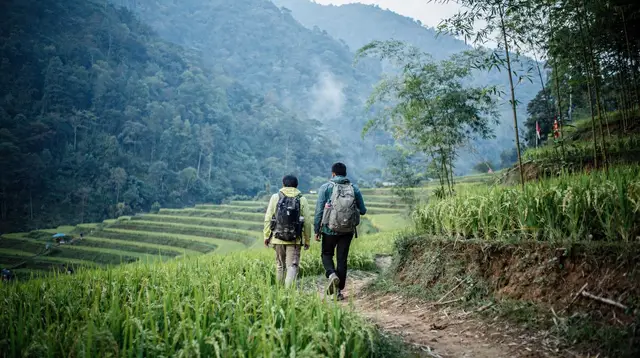
Vietnam Trekking Adventure: 14 Days of Mountain Bases by Public Transport
Can you trek Vietnam's mountains in two weeks without a car?
Yes. This route strings together six walking bases, Sapa, Ha Giang, Mu Cang Chai, Pu Luong, Phong Nha and Da Lat, using night trains, buses, one domestic flight and organised transfers. Expect long travel days between the northern bases, and plan the trip for late September to early October if you want golden terraces.
Two weeks, six mountain bases, no car
This is a walking itinerary. Each stop is a base from which you hike for a day or two, and the stops are joined by night trains, buses, a single domestic flight and organised transfers. You never drive yourself. That keeps costs sensible and spares you the worst of Vietnam’s mountain roads, which are narrow, slow and shared with lorries and motorbikes.
It is also a demanding trip. The northern bases lie on separate mountain roads, so the map looks short and the journeys are long. Read the day-by-day plan below with the transit hours in mind, and treat the rest days as optional padding you may have to borrow.
If you would rather take the back roads in a rented vehicle with a driver, the off-the-beaten-path itinerary covers that; this page assumes public transport and organised pickups only.
Choose the season first
Vietnam is long, and this route crosses three climate patterns, so the month matters more than any other choice.
| Region | Best window | Avoid |
|---|---|---|
| North (Sapa, Ha Giang, Mu Cang Chai, Pu Luong) | October–November, with spring as a mild second choice | Typhoon risk roughly July–September; grey, cold winter |
| Centre (Phong Nha) | Roughly February–August | Rains from roughly September–December, typhoons and floods most likely October–November |
| Da Lat | All year, cool because of its altitude | Heavy wet-season showers, roughly May–November |
Rice terraces are green from about June and turn golden around September and October. If you want gold, go in the last days of September or the first days of October and accept a small chance of rain and a typhoon warning in the centre. If you want the safest weather for the whole chain, aim for roughly February to April, when most of the country is workable at once, and accept green rather than golden terraces. Our best time to visit Vietnam guide and the rainy season and typhoons page give the month-by-month detail.
Day 1 — Hanoi, then the night train north
Land at Noi Bai, about 45 to 70 minutes by road from the centre, and drop your bags at a hotel. Spend the afternoon on a light walk in Hanoi: the Old Quarter, Hoan Kiem Lake and an early dinner of bun cha. Do not over-schedule. You have a long night ahead.
In the evening take the sleeper train to Lao Cai, roughly eight hours. Book a berth in advance, since the carriages sell out in high season. The Vietnam train travel guide explains classes and how to book.
Day 2 — Sapa and the Muong Hoa valley
You arrive at Lao Cai at dawn, and a minibus climbs to Sapa in roughly an hour. Leave your main bag at the hotel and set out on the first walk: down the Muong Hoa valley through terraced fields and Hmong and Dao villages, with a homestay lunch. The trails are muddy after rain and the tracks can be steep, so wear shoes with a grip.
Guided walks give context and keep you on the right paths. See Sapa for hotels and Sapa trekking tours for the guided options.
Day 3 — Fansipan, then back to the train
Fansipan, at 3,147 m, is the highest peak in the country. You can climb it on foot over one very long day or two, with a guide and porters, or ride the cable car and walk the last stretch of steps. Mist is common, and views are a lottery. Start early, carry a waterproof layer and expect it to be cold at the summit even when Sapa is mild.
Come down in the afternoon and take the night train back to Hanoi, or a sleeper bus if trains are full.
Day 4 — Hanoi, then Ha Giang
You reach Hanoi at dawn. Shower, eat and rest a few hours. Around midday take a bus or limousine minibus to Ha Giang town, roughly 300 km and six to seven hours on a good day. Check in, arrange your gear for the loop and sleep early.
Day 5 — Ha Giang loop, first day
The Ha Giang loop crosses the Dong Van Karst Plateau, which is a UNESCO Global Geopark rather than a World Heritage Site. On the first day you climb through Quan Ba and the Twin Mountains toward Yen Minh and Dong Van, with village markets and stone houses on the way.
Most visitors ride pillion behind a local easy rider, who knows the roads and carries your bag. Riding yourself is a separate decision: it needs the right licence, and insurers often refuse a claim without one. Read is the Ha Giang loop safe and renting a motorbike in Vietnam before choosing. Compare Ha Giang loop tours too; this one is a three-day option, a mountains-to-sea journey that continues to Ha Long, which you would not use here but which shows how the packages are built.
Day 6 — Ma Pi Leng and the way back
From Dong Van you ride the Ma Pi Leng Pass, the dramatic cliff road above the Nho Que river, then continue to Meo Vac and return toward Ha Giang town. This is a compressed two-day loop. Three days is better if you can spare it, with a slower run through the quieter valleys, but this plan trades that for the rest of the route. Expect long hours and a sore back.
For more on the area, see Ha Giang.
Day 7 — Back to Hanoi
Take the morning bus to Hanoi, arriving mid-afternoon. Use the evening to wash clothes, repack for rain and dinner. If you are tired, this is the day to take a proper rest and skip any sightseeing.
Day 8 — Hanoi to Mu Cang Chai
Mu Cang Chai lies in the high mountains northwest of Hanoi. By limousine minibus or organised transfer, roughly 250 to 300 km, count about six to seven hours and a lot of bends. Aim to arrive before dark. The terraces here fall in curves down the valley sides, and the first view from the road is worth the journey.
Read the rice terraces guide for the seasons, and the Mu Cang Chai page for places to stay.
Day 9 — Walking the terraces
Spend the day on foot between the terraces and the Hmong and Thai villages. A local guide opens trails you would not find alone and explains the planting calendar; one option is a full-day private trek through Mu Cang Chai, which fits well here. In late September the fields glow gold. Earlier in the summer they are green and no less lovely, but a heavy shower can close the road, so keep the day flexible.
Day 10 — Over to Pu Luong
A long transfer takes you south across the hills to Pu Luong, a quieter reserve of terraces, stilt houses and bamboo water wheels. Allow most of the day. Settle in at an eco-lodge and take a short afternoon walk along the paddies. The valleys are gentler than Sapa or Mu Cang Chai, which suits tired legs.
Day 11 — Pu Luong, then Hanoi
Spend the morning on the water: a jeep and kayaking adventure along the Cham stream near Don village is an easy way to combine a village visit with a paddle. After lunch take the transfer back to Hanoi, roughly four hours, and sleep close to the airport if your flight is early.
See also Pu Luong for the full picture.
Day 12 — Fly to Dong Hoi, then Phong Nha
The north and the centre are separated by a flight, not a day trip. Take an early domestic flight from Hanoi to Dong Hoi, a little over an hour; the domestic flights guide covers carriers and baggage rules. From the airport it is about an hour by road to Phong Nha, with a private car easy to book.
After lunch visit your first cave. This is Phong Nha-Ke Bang, a UNESCO World Heritage Site since 2003, with some of the largest cave systems on earth.
Day 13 — Caves, then the flight south
Spend the morning in Paradise Cave and Phong Nha Cave. A guided visit to Phong Nha and Paradise caves covers both in a day, and you can add a short jungle walk. Son Doong, the world’s largest known cave passage, needs an expensive and limited permit and a multi-day expedition booked far ahead, so it sits outside this budget. If it interests you, read the Son Doong guide separately; the Phong Nha cave tours page lists the standard visits.
In the afternoon transfer back to Dong Hoi and fly to Da Lat. There is no direct flight on most days, so you connect through Hanoi or Ho Chi Minh City. Check the schedule carefully and keep a buffer, because a missed connection costs you the next morning.
Day 14 — Da Lat in the cool
Da Lat sits at roughly 1,500 m on the Lang Biang plateau and is cool all year, which is a relief after the heat of the coast. Use your last day for a gentle walk in the pine hills, a waterfall or a viewpoint over the valley, and a coffee at a hillside café. For routes and guides, see Da Lat trekking and hiking.
Fly home or onward from Lien Khuong airport, roughly 30 km from the town.
Money, kit and safety
Cash still matters in villages, markets and homestays, while hotels, tours and larger restaurants accept cards. Vietnam uses the dong, which was roughly 26,000 to the US dollar in mid-2026 and drifts slowly downward, so give any budget a year. Budget mid-range here means comfortable guesthouses, homestays and a few guided days, not luxury.
Pack a rain shell, a warm layer for Sapa and Da Lat, broken-in shoes and a small first-aid kit. Tap water is not drinkable anywhere in Vietnam, so carry a filter bottle. Emergency numbers are 113 police, 114 fire and 115 ambulance.
Questions about trekking Vietnam in two weeks
Is this itinerary realistic in 14 days?
It is realistic but tight. The northern bases are far apart on mountain roads, so roughly four of the fourteen days are mostly spent in transit. Drop Pu Luong or shorten the Ha Giang loop if you want slower days.
When is the best time for this route?
The north is best in autumn, October to November, and the rice terraces are golden around September and October. The centre has its rainy season from roughly September to December, with typhoons most likely in October and November. Late September to early October is the compromise, and February to April is the safer alternative if you can live without golden terraces.
Do I need to ride a motorbike on the Ha Giang loop?
No. Most visitors ride pillion behind a local easy rider, or join a minibus or jeep tour. Riding your own motorbike needs the right licence, and many insurers refuse claims without it.
Can I do the Son Doong cave on this trip?
Son Doong needs a costly, limited multi-day permit expedition booked well in advance, so it is outside the budget of this page. Phong Nha Cave and Paradise Cave are the practical alternatives.
How do I get from the north to the centre?
By air. A domestic flight from Hanoi to Dong Hoi takes a little over an hour, while the same distance by rail or road would eat most of a day or more. Never plan it as an overland hop.
Do I need a visa for Vietnam?
It depends on your nationality. Vietnam issues e-visas valid up to 90 days and grants short exemptions to some countries, so check the official immigration portal or your government’s travel advice before booking.
What should I pack for a trekking trip across Vietnam?
Pack for several climates. Bring waterproof layers and warm clothing for Sapa and Da Lat, light quick-drying clothes for Pu Luong and Phong Nha, broken-in walking shoes and a rain cover. Tap water is not drinkable, so carry a filter bottle or buy bottled water.
Trekking and Hiking in the Northern Mountains and Beyond
Verified deep-linked GetYourGuide tours. Book through these links and we earn a small commission at no cost to you.
GetYourGuide does not provide a product photo for this activity — the image shows the meeting point, photographed by us.